History
Kullu was once known as Kulanthpitha – `the end of the habitable world`. Beyond rose the forbidding heights of the Greater Himalayas and, by the banks of the shining river Beas, lay the fabled `Silver Valley`.The Chinese pilgrim monk Xuanzang visited the Kullu Valley in 634 or 635 CE. He described it as a fertile region completely surrounded by mountains, about 3,000 li in circuit, with a capital 14 or 15 li in circumference. It contained a stupa (tope) built by Ashoka, which is said to mark the place where the Buddha preached to the local people and made
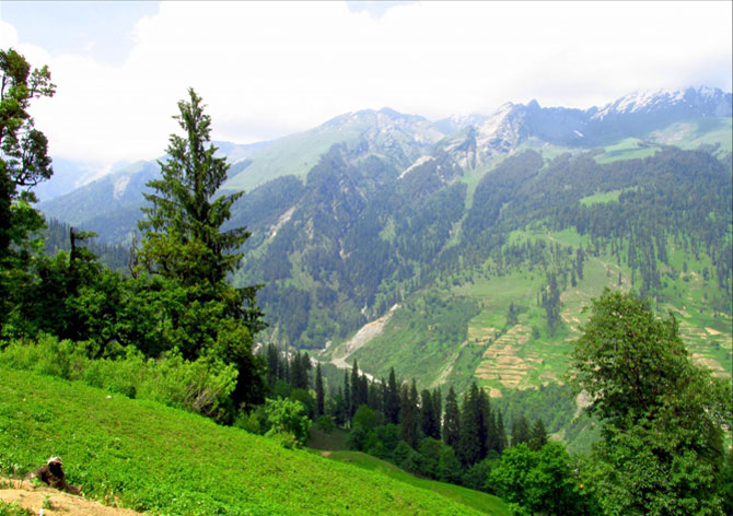
conversions, stupa was taken away by a mughal ruler and put in feroz shah kotla maidan in Delhi. There were some twenty Buddhist monasteries, with about 1,000 monks, most of whom were Mahayanist.There were also some fifteen Hindu temples, and people of both faiths lived mixed together. There were meditation caves near the mountain passes inhabited by both Buddhist and Hindu practitioners. The country is said to have produced gold, silver, red copper, crystal lenses and bell-metal.Kullu got its first motorable access only after Indian Independence. The long centuries of seclusion have, however, allowed the area to retain a considerable measure of its traditional charm. The road through the Kullu Valley and Lahaul is now paved all the way, to connect and provide the major access route between the northern Indian plains to Leh in Ladakh.
General Information
- Population:437,474
- Area:5,503 km2
- Literacy: 80.14
- Tehsils: Kullu, Nirmand, Banjar, Manali and Anni.
- Sub-Tehsils: Sainj.
- Sub-Divisions: Kullu, Anni, Banjar and Manali.
- Panchayat: 204
Map

Demographics
According to the 2011 census Kullu district has a population of 437,474 roughly equal to the nation of Malta. This gives it a ranking of 553rd in India (out of a total of 640). The district has a population density of 79 inhabitants per square kilometre (200 /sq mi) . Its population growth rate over the decade 2001-2011 was 14.65 %. Kullu has a sex ratio of 950 females for every 1000 males, and a literacy rate of 80.14 %.
Climate
Summer
During summers, the weather is very plesant and the maximum temperature hardly reaches 30 degree Celsius in the day, while the nights still retain a bit of chill. Summer is the season when tourists come in large number. When rest of India goes through extreme heat Kullu offers respite, with its cool and calm climate. Light woolen and cotton clothing is ideal during this weather condition.
Winter
Extreme weather is observed in Kullu during the winters, when the temperature may go down to freezing point. From December to February. Heavy woolen clothes are required during this weather. Temperature in Kullu are lower as compared to Manali which is at a greater height.
How To Reach
By Road
Kullu can be reached from Delhi by national highway NH 1 up to Chandigarh and from there by national highway NH21 that passes through Bilaspur, Sundernagar and Mandi towns. The road distance from Delhi to Chandigarh is 248 km and from Chandigarh to Kullu is 233 km; the total distance from Delhi to Kullu thus is 481 km. NH21 goes further to Manali and from there to Rohtang Pass and Leh.
By Rail
Kullu is not easily approachable by rail. The nearest broad gauge railheads are at Chandigarh (235 km) away and Pathankot. The nearest narrow gauge railhead is at Joginder Nagar (100 kilometres) away.
By Air
The nearest airport is at Bhuntar town, situated on NH21 at the confluence of the Parvati and Beas rivers (latitude 31.8763 N and longitude 77.1541 E), about 10 km (6.2 mi) south of Kullu town. The airport is also known as Kullu-Manali airport and has more than a kilometre long runway. Indian Airlines and some private airlines have regular flights to the airport.Chandigarh airport is the nearest large airport.


